Then There's This: Highway 45 Revisited
Except for the mayor, Council reaffirms opposition to 'aquifer toll road'
By Amy Smith, Fri., May 23, 2014


The more one considers the plan for State Highway 45 – its patchwork of moving parts, the clever side-stepping of federal environmental requirements, and the overall potential backwash – the more nightmarish things look.
As last week's resolution passed by City Council makes clear in so many "whereases," there has been no comprehensive, fully inclusive study of how all the puzzle pieces will fit together should the toll road actually materialize. Nor has there been a thorough vetting of the traffic, environmental, and financial impacts of the road, which would travel across the recharge zone of the Edwards Aquifer to link the southern tip of MoPac to FM 1626 in Hays County.
The resolution passed on a vote of 6-1, with Mayor Lee Leffingwell voting no, stating his belief that the road project is already a done deal based on agreements already reached between Travis and Hays counties, the Capital Area Metropolitan Planning Organization, and the Texas Department of Transportation. "If it is not built, it won't be because of this resolution," he said, casting doubt on the optimism expressed by resolution sponsor Kathie Tovo before the vote reaffirming the city's opposition. "I think that's an important message to send to our partners," she said.
On that score, the resolution directed the city manager to reach out to those partners as well as the Regional Mobility Authority (or the toll road authority) to better establish Austin's place at the table, done deal or no.
Given that SH 45 has been on and off the transportation planning maps since the late Eighties, it's understandable that the big-picture scope of the project is rather hazy. But the Council resolution breaks down the road plan's shortcomings point by point, beginning with the statement that SH 45 would effectively turn MoPac into a "western Interstate Highway 35 alternative [that] has not been studied or carefully considered" by the participating agencies.
Give 'Em an Inch ...
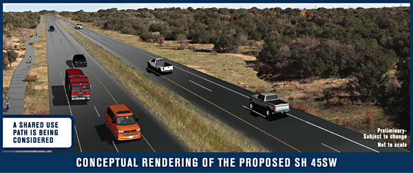
In its infancy, SH 45 Southwest was envisioned as a major piece of a circular loop around Austin that would extend from South MoPac to SH 130. In its current incarnation, proponents are pitching SH 45 as just a little innocent country road stretching just under four miles – though no one really believes it'll stay that size if this part gets built. Meanwhile, regional planners are weighing improvements to the southern end of MoPac from the point where the bridge crosses Lady Bird Lake, but TxDOT and CAMPO are viewing them as entirely separate projects apart from SH 45, which road boosters want to build first. The resolution advises that it would be prudent to first complete studies for South MoPac and the Lady Bird Lake bridge before starting work on the toll road.
In addition, the resolution cites traffic studies by CAMPO and UT's Network Modeling Center that reveal "only a limited transportation benefit" to Shady Hollow residents who are pinning their hopes on SH 45 alleviating congestion on Brodie Lane, the roadway that Hays County residents and other commuters use to cut through their neighborhood to get to MoPac and beyond.
Remember – SH 45 was sold to voters as a "safety issue" in the county bond election of 1997, and voters overwhelmingly approved bond dollars to pay for right-of-way purchases along the route. "Safety" is no longer used to market the project that is primarily driven by real estate and political interests (aided by vocal Shady Hollow neighbors), just as it's been throughout its cyclical lifespan. To illustrate the point about the road being development-driven, at taxpayer expense, consider this Feb. 15, 2002, dispatch from former Chronicle scribe Mike Clark-Madison: "In a victory for Southwest suburbanites and, in particular, developer Gary Bradley, the CAMPO board voted Monday not to delete [SH 45] – the erstwhile Outer Loop – from the region's long-range transportation plan." Come to think of it, our archives provide an apt summary of the project's herky-jerky history: "TxDOT Scuttles SH 45 South – For Now," reads a headline from July 2002, just five months after Clark-Madison's report under the headline "CAMPO Keeps SH 45."
Environmental Obligations
One constant throughout the long-running road debate is the road's location in the Barton Springs segment of the aquifer. Pro-SH 45 folks insist that this will be the most environmentally sensitive road in Central Texas, and it probably will be, but there's a limit to how environmentally sensitive a major highway can be. Moreover, both the city and county jointly hold what's called a Balcones Canyonlands Conservation Plan regional permit with the U.S. Fish and Wildlife Service. Under that permit, they're required, as the resolution notes, to "preserve the environmental integrity of Flint Ridge Cave," a recharge feature for the aquifer, located on city land. Federal laws also require protection of the Barton Springs salamander, and recent environmental studies by city staff have shown that recharge from the proposed route could reach Barton Springs in three to four days.
Then, too, the city has important real estate interests of its own – our own – to consider, and that's the $40 million we've plunked into preserve lands under the BCCP permit, specifically to guard against unwanted and potentially harmful development like SH 45.
Got something to say on the subject? Send a letter to the editor.