TODs and Their Zones
What's what (and what's planned) at Austin rail stops
Fri., Nov. 26, 2010


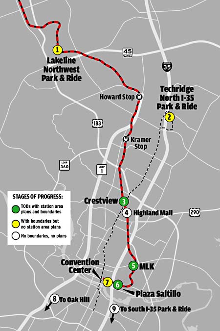
A total of nine transit-oriented development zones have been created by city of Austin, six of them around MetroRail Red Line stations. Leander has also established a TOD around its Red Line station. And while Kramer Station is not officially a TOD zone, the city of Austin's North Burnet/Gateway Master Plan calls for transit-oriented development in that area.
The TOD ordinance creates four classifications of zones: "neighborhood centers" (lowest density, buildings no higher than four stories), "town centers" (moderate density), "regional centers" (major commuter or employment center), and "downtown" (high-rise development). So far, none of the zones have been labeled as "regional." See more information at the city's TOD website: www.cityofaustin.org/planning/tod.
1) Lakeline/Northwest Park & Ride (town center)
One office park; otherwise, all empty fields
2) Techridge/North I-35 Park & Ride (town center)
Not on a rail stop but centered around a bus park & ride. A dense apartment complex exists in the southern part of the zone; otherwise, it's open fields and office park/strip mall hell.
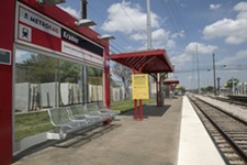
3) Crestview (neighborhood)
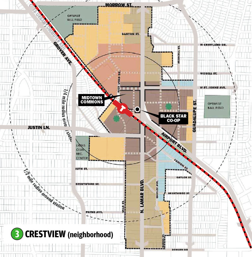
• This zone has seen the completion of Midtown Commons, a mixed-use retail, office, and residential development north of the station (part of the TOD mixed-use package in brown). Residential is full, while retail and office are lagging.
• Home to Blackstar Co-op Pub and Brewery, conveniently located mere steps from the rail station.
• Other features will include live/work flex spaces (blue), medium- and high-density residential (in orange and pink, respectively), and mixed-use development (light brown).
4) Highland Mall (town center)
Boundaries and zones to be determined during station area planning.
5) MLK (neighborhood)
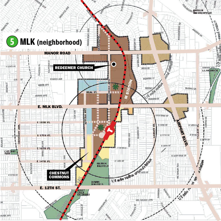
• Mostly empty, but three blocks of dense bungalows (Chestnut Commons, see picture) have been built to the southwest of the MLK Station, completing part of the low-density planning area (in yellow).
• An affordable housing project, Foundation Communities' M Station, is under way on a stretch of property at MLK and Alexander in the designated TOD mixed-use areas (in brown).
• Redeemer Presbyterian Church, north of the affordable housing project, cited its religious status in refusing to comply with the TOD zoning.
• The remaining area shows existing city parkland (green), planned live/work spaces (blue), and medium- (orange) and high-density (pink) residential development on busy roadways within the TOD zone.
6) Plaza Saltillo (neighborhood)
Already transitioning to denser development as a consequence of proximity to Downtown but still has a lot of warehouse-style light industrial businesses
7) Convention Center (downtown)
The city's TOD website says "Station Area Planning will be handled through a separate consultant-led downtown planning process."
8) Oak Hill (town center)
After Capital Metro selects a transit center site, boundaries and zones will be determined through a neighborhood planning process. Not on the rail line.
9) South I-35 Park & Ride (town center)
Not on the rail line. Park & ride is yet to be constructed.
Got something to say on the subject? Send a letter to the editor.