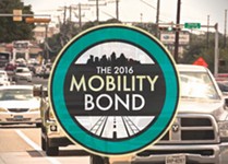
Roaming the Corridors
Fri., June 8, 2018


1) Guadalupe
From 18th Street to 29th Street, and 24th Street from Guadalupe to Lamar
The Drag has garnered the most attention, with the car crowd howling about a proposal to scrap two traffic lanes to make way for dedicated bus lanes, and urbanists barking when that idea got shelved. What is happening is a northbound "contraflow lane" reserved for buses on a small strip of road between 18th and MLK, where currently traffic only runs south. The idea is to allow buses going northbound on Lavaca to get over to Guadalupe via 18th Street, rather than sending them through the messiness of MLK. More dramatic changes will take place on a couple of streets that feed into Guadalupe: Nueces will begin servicing two-way traffic, and 24th Street between Lamar and Guadalupe will get a continuous center turning lane and bike lane, but will lose one of its four vehicle lanes. ATD public information specialist Sara Behunek says the new configuration – one car lane in each direction and a continuous left turn lane in the middle – will make things safer for bikers and more efficient for drivers, who will "no longer back up while waiting for someone to turn left in a through lane." Nueces and 24th will also get 1.5 miles of new pavement, and Guadalupe will get three new traffic signals, a bunch of new street lighting, and up to 4.5 miles of new or rehabilitated sidewalks.
2) South Lamar
From Riverside to Ben White
The perennially congested corridor will be the recipient of a lot of new amenities, including 15 new traffic signals, improvements to seven intersections, up to three miles of new pavement, median islands, and transit enhancements at five intersections so that buses get stuck at lights less often. Depending on logistics and funding, the plan could also "potentially" include four new pedestrian beacons to make it easier for walkers to cross the harrowing road. The city is considering putting roundabouts at both Mary & Evergreen and Del Curto & Bluebonnet. The original plan also called for a half-mile of full street reconstruction between Panther Trail and Ben White, including wider sidewalks and protected bike lanes, but at the behest of district representative Ann Kitchen, City Council voted in April to redirect those improvements to a portion of Lamar between Riverside and Barton Springs, more likely to be used.
3) North Lamar
From Highway 183 to I-35
The stretch of Lamar running from Highway 183 to Howard Lane will receive 13 new traffic signals, intersection improvements at Rundberg, Braker, and Parmer, a number of new median strips, and 5.5 miles of new pavement. Expect reconstructed bridges at Highway 183 and Walnut Creek. Staff is also considering nine new hybrid beacons along the corridor and up to a mile of street reconstruction between Thurmond and Rundberg that would bring protected bike lanes, wider sidewalks, more street lights, and streetscaping.
4) Burnet Road
From Koenig to MoPac/Loop 1
Burnet could get 19 new traffic signals and intersection improvements at Koenig, Braker, Kramer, Esperanza Crossing, and Gault, along with five miles of pavement rehab and 10 miles of new shared-use paths to facilitate off-street biking and walking. The city is considering six new hybrid beacons at Allandale Road, Twin Oaks Drive, Northcross Mall, Ashdale Drive, Penny Lane, and the south side of Highway 183.
5) MLK/FM 969
From Highway 183 to Webberville
East MLK/FM 960 serves the rapidly growing population that is settling east of the urban core, where housing is cheaper but city services like public transit are minimal, and roads are inhospitable to bikers and pedestrians. In addition to up to four new traffic signals and intersection improvements at Decker, the corridor will get 3.5 miles of shared-use paths so that people can bike and walk along the road, separate from traffic, with plans to connect to the Walnut Creek Trail. In a similar vein, the bridge over Walnut Creek will get wider sidewalks and new speed ramps aimed at protecting bikers. There will be a new signalized crosswalk at Sendero Hills and a wider pedestrian and bike crossing at the nearby railroad tracks.
6) East Riverside
From I-35 to Highway 71
East Riverside gets the full urbanist treatment, including four miles of protected bike lanes, new street lighting, and wide sidewalks. The full corridor will get 14 new traffic signals, three miles of new pavement, and intermittent median islands to "improve vehicular and transit efficiency, and safety for everyone," says the city's Transportation Department. There will also be a certain number of "streetscape enhancements," such as trees, benches, and banners that promote community organizations. And there are plans to at least study putting new pedestrian hybrid beacons at Summit, Willow Hill, and South Pleasant Valley.
7) Airport Boulevard
From Highway 183 to North Lamar
The central corridor east of I-35 will welcome 6.5 miles of new pavement, 21 new traffic signals, and a series of intersection improvements at MLK, Manor Road, Springdale, East Koenig, and East 45th. There may also be "up to" 13 miles of shared-use paths alongside the entire road, allowing bikers to go for miles without interaction with cars. The plan also calls for "possible" construction of nine pedestrian beacons to make crossing the road easier, and the potential for 6.5 miles of "full street reconstruction" between 183 and North Lamar, including wider sidewalks, protected bike lanes, and "enhanced streetscapes."
8) William Cannon Drive
From Southwest Parkway to McKinney Falls Parkway
William Cannon was not initially part of the bond proposal and likely wouldn't be on the list if not for Council Member Ann Kitchen, who refused to support the bond until it and Slaughter got included. The South Austin stretch could see seven traffic signal improvements and up to 18 miles of new or repaired sidewalks. There will also be five miles of protected bicycle lanes, including a protected lane in both directions between Ben White and Southwest Parkway that will come at the expense of one car lane on both sides, one of the few instances of lost car lanes on the corridors. Expect a new bridge over Marble Creek that's one lane wider on each side, as well as two new lanes between McKinney Falls Parkway and Running Water Drive. A vaguely defined series of "intersection improvements" will occur at Brodie, South Pleasant Valley, and Bluff Springs.
9) Slaughter Lane
From FM 1826 to Vertex Boulevard
Kitchen's advocacy netted Slaughter Lane as many as 28 new traffic signals, improvements at three intersections (Escarpment, Brodie, and South Congress/I-35), up to three miles of repaved roads, and 14 miles of dedicated bike lanes.
10) Regional Mobility
$101 million will go toward regional mobility projects (often built with city and state funds) for a handful of major highways and roads that feed into the city. These won't be coming any time soon, either. The most significant is a series of improvements along Loop 360. The city is going to invest $46 million to improve intersections at Westlake, Courtyard, Lakewood, and Spicewood Springs/Bluffstone, part of a $204 million state project that includes four other spots on that route. Construction is not anticipated to start until the end of 2024.
The city is also collaborating with TxDOT to make a series of improvements on Parmer Lane between SH 45 and Brushy Creek, including "innovative intersections." While the city is only committing $17 million, the state may separately commit $35-40 million to build a third vehicle lane.
The city has budgeted another $17 million to widen Spicewood Springs from two lanes to four between Loop 360 and Mesa, beginning in 2022. Another $7.26 million is reserved for a series of safety improvements along Anderson Mill between RM 620 and RM 2222.
That's an Improvement: Decoding What's Coming to the Nine Corridors
Pedestrian Hybrid Beacons
One of the major challenges to walking on major corridors is literally crossing the street. They often don't have crosswalks for many blocks at a time, and jaywalking is neither safe, legal, nor possible, with all the traffic. One way to make walking easier is to add pedestrian hybrid beacons: crosswalks equipped with a traffic light that pedestrians can activate to stop traffic and cross the road safely.

Protected Bike Lanes
The most common bike lanes are "designated lanes" that amount to nothing more than a striped-off section of the road. They're better than nothing, but a large chunk of the population won't bike unless there's something that provides greater separation from cars. Protected bike lanes are the next step up; they provide an actual barrier between bikers and traffic. Shared-use paths are 8- to 10-foot concrete paths for pedestrians and bikers, entirely separate from the road.

Intersection/Traffic Signal Improvements
Enhanced intersections are the crux of the plan to reduce congestion on the corridors. They include a variety of potential changes, including new turn lanes and "smart" traffic signals that react to actual traffic conditions to optimize car flow and prevent people from being stuck at a red light for a long period of time. Many of the traffic lights may also include "transit signalization priority" that will prioritize passage of approaching buses over cars.
Got something to say on the subject? Send a letter to the editor.