Day Trips
Los Adaes, the first capital of Texas, once stood on the edge of the world stage
By Gerald E. McLeod, Fri., Jan. 19, 2007


Los Adaes, the first capital of Texas, once stood on the edge of the world stage. A tiny outpost in the thick forest of western Louisiana, Presidio Nuestra Senora del Pilar de los Adaes was the first line of defense for New Spain.
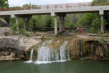
The forest grows to the edge of the road leading from Robeline, La., to Los Adaes State Historic Site. At the park, an outline of logs snakes over the curve of the hill showing where the fort's walls once stood. The park seems to be crowded by the towering pines and thick underbrush of the forest nearly three centuries after the stockade offered protection.
El Camino Real de los Tejas began in Mexico City and ended 29 miles east of the Sabine River at Los Adaes. There were many versions of the King's Highway, depending on the weather. The route roughly followed modern highways from Eagle Pass on the Rio Grande to San Antonio, before it became TX 21 through Bryan, Crockett, and Nacogdoches to the Sabine River where it became LA 6.
The Spanish chose the site for Los Adaes because it was near four missions and 15 miles from the French settlement at Natchitoches in the heart of Caddo Indian country. The people we call the Caddo Indians were actually a confederation of clans that lived from the Grand Bend of the Red River in southern Arkansas to the Brazos River. The name comes from Kadohadacho, the dominate tribe in the area. Their word for the surrounding tribes was "taysha" or tejas, which meant friend. Gradually the name was applied to the entire Spanish province north of the Rio Grande.
It was a Frenchman who led the Spaniards to Louisiana, where his countrymen had made deep inroads into the Indian culture through trade. Spain hoped to outmaneuver France for a hold on the region by converting the native people to Catholicism. While the Indians were seldom hostile to the Spanish, they never congregated around the missions that were founded in 1717.
Life at Spain's northeasternmost outpost was as difficult as one might imagine. Without the help of the Indians they came to colonize, the settlement might have been lost as soon as it began. The French in Nachitoches, with their access to trade goods from the coast, helped supply the presidio and missions despite Spanish laws to the contrary.
Manned by 100 soldiers, the fort was surrounded by a hexagonal stockade with three bulwarks. Inside the walls were log buildings used as a chapel, guard house, barracks, blacksmith shop, and powder house. The military force was seldom at a full complement as soldiers did duty protecting the missions and livestock, working in the fields, and patrolling from unlicensed traders.
In 1729, Spanish authorities designated Los Adaes as the capital of the Texas territory. This choice overlooked San Antonio de Bexar, which had been founded about the same time and was much closer to supplies. The location had the advantage of being among friendly Indians, though unresponsive to conversion, and it reminded France of Spain's claim to the western lands.
For 44 years, Los Adaes was the administrative seat of the province. By 1762, the French transferred Louisiana to Spain. Without the threat of foreign intervention, Spanish officials ordered Los Adaes closed, and the inhabitants moved to San Antonio. More than 500 soldiers and their families were forced to make the march south. It wasn't long before many of them headed back to East Texas, where they began building Nacogdoches.
Los Adaes State Historic Site is about 30 miles east of the Texas border and a mile northeast of Robeline on LA 485. Besides the outline of the presidio, the 14-acre park has hiking trails through the woods and regular interpretive programs. A small museum at the site displays artifacts found in the area along with diagrams of the fort. Open daily from 9am to 5pm, a docent can give more information at 318/472-9449. The Louisiana parks department can be found at www.crt.state.la.us/parks. The Adai Indian Nation has a cultural center a couple of miles north of the park. For information, call 877/472-1007 or go to www.adaiindiannation.com.
812th in a series. Day Trips, Vol. 2, (trips 101-200), is available for $8.95, plus $3.05 for shipping, handling, and tax. Mail to: Day Trips, PO Box 33284, South Austin, TX 78704.